AI is moving off the screen and into the physical world, where it has to make sense of real 3D space. While cameras provide rich visual detail, autonomous vehicles (AVs) and robots also rely on Light Detection and Ranging (LiDAR) to accurately gauge depth and geometry. The LiDar data these systems produce must be processed and identified before a model can learn from it.
For example, when an AV approaches a crosswalk at night, cameras can struggle in the dark. Its LiDAR sensor keeps scanning the surroundings with laser pulses, mapping the scene as millions of points.
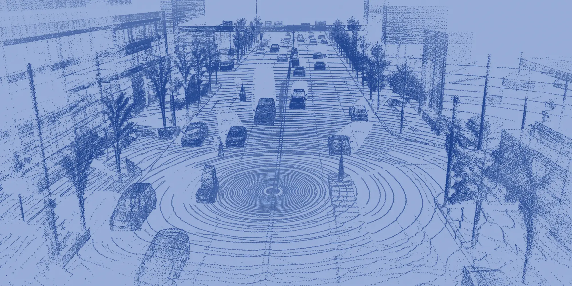
Somewhere in those points, a cyclist might be waiting to cross. The vehicle’s ability to recognize that cyclist depends, in part, on thousands of previously trained examples captured from different angles and distances. That is the work of LiDAR annotation, where quality directly influences how accurately physical AI interprets its surroundings.
What is LiDAR annotation?
A LiDAR sensor measures how long each laser pulse takes to bounce back, turning each return into a point with a location in 3D space. Together, those points form a 3D representation of the surrounding environment (a “point cloud”).
Annotators label point clouds in a few common ways. They draw 3D bounding boxes, or cuboids, to mark where an object is and how big it is. Semantic segmentation assigns a class to individual points, such as road or vegetation. Instance segmentation goes further and separates objects of the same type, so two cars parked side by side are labeled as two cars.
Labels can also carry across a sequence of frames. In 4D object tracking, each object keeps the same identity over time so a model can learn how it moves. Depending on the project, annotations may also be matched to camera or radar data captured at the same moment.
Together, these labels teach a machine to read the space around it, and more and more machines are depending on that ability.
LiDAR use cases from AVs to robotics
Autonomous driving was the first to rely on LiDAR annotation at scale, and is still one of the most established use cases. Robotaxis, driver assistance systems and autonomous trucks use 3D data to detect vehicles, pedestrians and road boundaries. Labeled data supports model training and testing, and it’s especially valuable for rare situations a model hasn’t encountered often.
LiDAR also helps autonomous mobile robots (AMRs) navigate warehouses and manufacturing plants, where they must move around people, equipment and obstacles. Humanoids and other robots may combine LiDAR with cameras and depth sensors to interpret their surroundings.
Sidewalk delivery robots and some drones use spatial data to navigate around pedestrians, curbs and buildings. On farms, mine sites and construction sites, autonomous equipment must interpret uneven terrain and changing conditions without conventional road markings to guide them.
There’s a wide range of machines and settings but the labeling problems they share start with the data itself.

The challenges of 3D labeling
Going back to the cyclist in the crosswalk. They might register as a few dozen scattered points in the point cloud. With so little visual information, it’s easy to misidentify or miss them entirely. Annotators deal with ambiguous, low-visibility scenes like this constantly.
Distance and limited visibility. The farther an object is from the sensor, the fewer points it typically produces. A nearby car may appear as thousands of points and a distant one as a handful, yet both need to be labeled correctly.
Missing visual context. Without color or texture, objects with similar shapes can be hard to tell apart. Annotators may check synchronized camera images to confirm what they’re looking at.
Occlusion and overlapping objects. Cars, people and equipment frequently block one another. Depending on the project’s rules, annotators may need to estimate an object’s full size from the portion they can see.
Environmental conditions. Rain, fog, dust and reflective surfaces can create noise or gaps in the data. Clear guidelines help annotators distinguish real objects from sensor artifacts.
Movement over time. In tracking work, objects turn, disappear behind obstacles and reappear. Each needs to maintain the same identity and follow a realistic path from frame to frame.
Unusual scenarios. A person pushing a shopping cart across a parking lot or a forklift carrying an oversized load may fall outside common training examples. Cases like these call for human judgment and often prompt updates to labeling rules.
Improving LiDAR annotation accuracy
Model-assisted pre-labeling can now generate initial annotations, reducing repetitive work but shifting more responsibility toward human review. Effective labeling is built on the right processes.
Start with clear labeling guidelines, which define each object class, explain how to draw boundaries and establish how ambiguous cases should be handled. They need regular updates as new situations arise.
Build consistency through training. Annotators need to understand the tools and the environments represented in the data. Practice rounds on shared examples, followed by feedback, help teams apply the rules consistently.
Use multiple layers of quality checks. Peer review, expert audits, reference datasets and automated checks each catch different mistakes. Quality measures should reflect the task, whether that’s bounding-box placement, object classification or tracking consistency.
Review automated annotations critically. Pre-labeling can accelerate production, but machine-generated labels aren’t always correct. Reviewers need to recognize subtle inaccuracies rather than approve predictions by default.
Connect annotation to model performance. Feedback from AI developers helps annotation teams identify recurring errors and difficult scenarios. Teams can then refine guidelines and focus their efforts on the data that needs the most attention.
FAQ: How TaskUs supports LiDAR annotation
TaskUs supports 3D data annotation for autonomous vehicles, robotics and other physical AI applications. This includes 3D bounding boxes, segmentation, object tracking and multi-sensor annotation for model training and evaluation.
We pair specialized annotator training with labeling guidelines and quality checks tailored to each client. For one autonomous vehicle client, a custom quality framework helped the program reach a 98% annotation accuracy score.
Yes. Our teams can work in client annotation platforms and alongside model-assisted pre-labeling. Human reviewers check and correct automated labels, especially for ambiguous objects and complex scenes.
Sensor data can include information about people, places and proprietary environments. TaskUs applies access controls and data handling protocols based on client requirements, with processes intended to protect privacy and confidentiality.


